
![]() Vince Uhl Phone: +1 (609) 947-1703
Vince Uhl Phone: +1 (609) 947-1703
![]() Ashish Daw Phone: +1 (609) 273-8390
Ashish Daw Phone: +1 (609) 273-8390
|
|
GIS, SPATIAL DATA MANAGEMENT and REMOTE SENSING |
||||
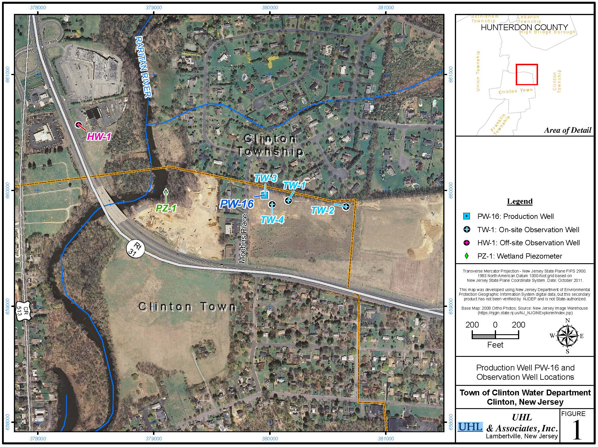
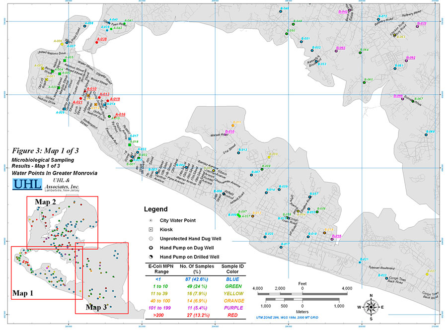
UHL & Associates integrates GIS in water resources planning, exploration, development and management projects. Internationally the Firm has integrated GIS and Remote Sensing techniques to process, analyze, and prepare field maps from published maps, aerial photographs and satellite images. UHL's GIS and Remote Sensing capabilities include:
 |
||||
| CONTACT US |
|
|||
|
||||